
Browse by Category
Fiction
- Action & Adventure
- African American
- Anthologies
- Children's Fiction
- Classics
- Comics & Graphic Novels
- Coming of Age
- Contemporary
- Cultural & Regional
- Drama
- Erotica
- Fantasy
- General
- Historical Fiction
- Horror
- Humor & Satire
- Literary Fiction
- Mystery, Thriller & Suspense
- Poetry
- Religious & Inspirational
- Romance
- Science Fiction
- Short Stories
- War & Military
- Westerns
- Women's Fiction
- Young Adult
Non-Fiction
- Antiques & Collectibles
- Arts & Photography
- Biographies & Memoirs
- Business & Money
- Children's Non-Fiction
-
Computers & Technology
- Artificial Intelligence
- Computer Science
- Cybersecurity & Cryptography
- Data Science & Analytics
- Databases & Big Data
- Game Development & Design
- General
- Hardware & DIY
- Mobile App Development
- Networking & Cloud Computing
- Operating Systems
- Programming
- Robotics
- Software
- Software Engineering
- User Experience (UX) & Design
- Web Development & Design
- Cooking, Food & Wine
- Crafts, Hobbies & Home
- Education & Teaching
- Engineering
- General
- Health, Fitness & Dieting
-
History
- African History
- African History - North Africa
- African History - Sub-Saharan Africa
- American History
- American History - 20th Century
- American History - Civil War
- American History - Colonial Period
- Ancient History
- Asian History
- Asian History - China
- Asian History - India
- Asian History - Japan
- Asian History - Southeast Asia
- European History
- European History - Ancient Greece
- European History - Ancient Rome
- European History - Medieval
- European History - Modern
- European History - Renaissance
- General
- Middle Eastern History
- Military History
- Military History - Aviation
- Military History - Naval
- Social & Cultural History
- World History
- Humor & Entertainment
- Industrial Technology
- Language Learning
- Law
- LGBTQ+ Non-Fiction
- Literary Criticism
- Medical Books
- Parenting & Relationships
- Philosophy
- Politics & Social Sciences
- Reference
- Religion & Spirituality
-
Science & Math
- Agricultural Sciences
- Astronomy & Space Science
- Behavioral Sciences
- Biological Sciences
- Botany & Plant Science
- Chemistry
- Earth Sciences
- Engineering - Chemical
- Engineering - Civil
- Engineering - Electrical
- Engineering - Mechanical
- Environment
- General
- Geology
- Mathematics
- Nature & Ecology
- Oceanography
- Paleontology
- Physics
- Statistics
- Self-Help
- Sports & Outdoors
- Study Aids
- Sustainability & Green Living
- Textbooks
- Transportation
- Travel
- True Crime
- Urban Planning & Development
- Veterinary Medicine
- Writing & Publishing
Jump to Section

Want unlimited access to all books published by MixCache.com (plus their audiobooks)? Try MixCache.com Total Access. Look for the MTA badge on book covers to identify included titles.
Access to infinite ebooks: Don't see the book you want? Suggest it and we'll create it (free!) for you from scratch with our powerful AI book writer. Then read it with MTA - besides profiting from any sales it makes!
The Art of Mapmaking in the Age of Exploration
MTA
How Cartographers Shaped the World
About this book:
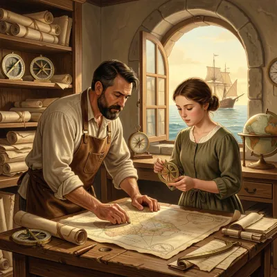
The book traces the evolution of mapmaking from rudimentary prehistoric sketches through the sophisticated traditions of antiquity, highlighting how the rediscovery of Ptolemy’s *Geographia* during the Renaissance provided a mathematical framework of latitude and longitude that revitalized European cartography. It examines the socioeconomic and technological catalysts of the Age of Exploration—such as the quest for new trade routes after the fall of Constantinople, advances in ship design, and the spread of navigational instruments like the magnetic compass and astrolabe—which created an urgent demand for charts capable of guiding trans‑oceanic voyages. Early practical solutions, particularly the portolan charts of Mediterranean mariners, combined empirical coastal detail with rhumb lines to aid navigation, even as their limitations spurred further innovation.
The narrative then follows the systematic Portuguese exploration of Africa, the bold but miscalculated westward voyages of Columbus, and Amerigo Vespucci’s insight that the lands encountered formed a distinct “New World.” It shows how Martin Waldseemüller’s 1507 map first depicted and named this continent America, how Magellan’s circumnavigation proved the Earth’s sphericity and revealed the vastness of the Pacific, and how Gerardus Mercator’s 1569 projection solved the problem of plotting constant compass bearings as straight lines, revolutionizing nautical charting. The work also covers the Dutch Golden Age of cartography, where firms like Blaeu and Hondius produced lavishly decorated, scientifically rigorous atlases that combined art, commerce, and state‑sponsored knowledge, while French cartographers under the Cassini dynasty pursued unprecedented precision through triangulation, and English seafarers contributed pragmatic charts driven by trade and privateering.
Further chapters explore the patronage of royal courts that turned maps into instruments of empire, the indispensable yet often uncredited contributions of indigenous geographical knowledge, and the rich artistic symbolism—sea monsters, allegorical figures, elaborate cartouches—that adorned Renaissance maps as both propaganda and aesthetic objects. The book details technological progress from parchment and woodcut to copperplate engraving and the printing press, which enabled mass dissemination and standardization of cartographic conventions, and it analyzes how maps facilitated territorial claims, treaties like Tordesillas, and colonial administration. It addresses the gradual overthrow of flat‑Earth ideas through empirical observations, the secrecy and espionage surrounding strategic charts, and finally, the enduring legacy of exploration‑era cartography in modern systems of latitude and longitude, projections, atlases, GIS, and the continued interplay of scientific rigor, artistic design, and geopolitical power in shaping how we visualize and navigate the world.
What You'll Find Inside:
- How Ptolemy's Geographia provided the essential mathematical framework of latitude and longitude that enabled scientific cartography, despite its inaccuracies that later spurred innovation through empirical discovery.
- The critical role of navigational tools like the magnetic compass and astrolabe in enabling oceanic voyages, and how explorers' observational data directly fed into mapmaking to create increasingly accurate charts.
- The Waldseemüller Map of 1507 as the first to recognize and name the Western Hemisphere as a distinct continent 'America,' fundamentally altering European understanding of global geography.
- Mercator's 1569 projection revolutionizing navigation by representing rhumb lines as straight lines, making it practical to plot constant compass courses across vast oceans despite polar distortion.
- How maps functioned as both scientific instruments and tools of empire, facilitating colonial expansion, territorial claims, and power dynamics between European nations through visual assertions of ownership.
Who's It For:
This book is ideal for history enthusiasts, geography buffs, and students of early modern exploration who want to understand how cartography shaped global discovery. It will particularly appeal to readers interested in the intersection of science, art, and power dynamics during the Age of Exploration, as well as anyone curious about how historical mapping techniques influence modern geographic understanding and technologies like GPS.
Author:
Published By:
Date Published:
August 2, 2026
Type:
Nonfiction
Language:
English
Word Count:
38,399 words
Reading Time:
2 hours 41 minutes
Sample:
MixCache.com Total Access
Get unlimited access to this book + all books published by MixCache.com for $11.99/month
Subscribe to MTAOr purchase this book individually below
Order:
Buy the The Art of Mapmaking in the Age of Exploration ebook on MixCache.com:
Buy Now
Full ebook will be available immediately
- read online or download as a PDF file.
$5 account credit for all new MixCache.com accounts, usable toward any ebook purchase!*



Ratings & Reviews
Ask Questions About This Book
Have a question about the content? Ask our AI assistant!
Start by asking a question about "The Art of Mapmaking in the Age of Exploration"
Example: "Does this book mention William Shakespeare?"
Thinking...