
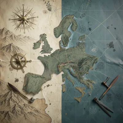
When a medieval sailor unfurled a portolan chart off the coast of Provence, he held more than a navigational aid — he held a technology that "invented a new kind of space" measured by bearing and experience rather than scripture. Brittany Gibson's Mapping Europe argues that this moment encapsulates a millennium-long truth: European maps have never been mere pictures of the world but among its most consequential makers.
What the book is about
Mapping Europe spans twenty-five chapters tracing cartography from thirteenth-century Mediterranean sea charts to twenty-first-century platform territories and algorithmic border enforcement. The book moves chronologically but thematically, examining how each cartographic regime — portolan charts, mappae mundi, printed atlases, triangulation networks, cadastral surveys, military maps, ethnographic mappings, Cold War grids, GIS databases, and navigation apps — served as both an image that persuaded and an instrument that measured, classified, and commanded. Gibson writes for readers who want to understand European history through its spatial technologies: historians, geographers, political scientists, and anyone who has ever wondered why a line on a map can determine who belongs, who decides, and where the lines are drawn.
Maps as arguments, not reflections
The book's central thesis crystallizes in its introduction: "Legibility is never neutral. A parish boundary drawn to assess tithes, a cadastral parcel fixed to levy taxes, a language frontier shaded to substantiate a plebiscite — these are acts that redistribute resources, rights, and risks." Gibson demonstrates this repeatedly. In Chapter 10, ethnographic maps "claimed to reveal 'natural' communities" but functioned as "instruments of imagination, designed to make nations visible where before there had been only a patchwork of dialects, loyalties, and overlapping jurisdictions." The map "did not invent the idea that language defined the nation, but it gave that idea a visual authority that no amount of prose could match."
The cadastral revolution and the Napoleonic state
Chapter 6 offers a masterclass in how mapping became governing. The 1807 Décret Cadastral ordered "a comprehensive survey of all landed property in France," producing maps at 1:2,000 scale where "colour coding distinguished different land uses" that "mirrored the fiscal categories that the state used to calculate taxes." The cadastre "was not merely a tool of taxation; it also reshaped the social landscape" by fixing property boundaries on paper, making them "visible, contestable, and, ultimately, enforceable." Gibson shows how this model spread unevenly across Europe — adopted in the Netherlands, adapted in German states, resisted in Italy and Spain — each iteration revealing the "reciprocal" relationship between cadastral maps and political power.
War as a cartographic accelerator
Two world wars transformed mapping from artisanal practice into industrial enterprise. Chapter 13 details how the Western Front became "a cartographer's nightmare and a cartographer's paradise" — existing maps obsolete within days, aerial photography and photogrammetry becoming indispensable. By war's end, "the British had photographed the entire Western Front from the air, producing over 100,000 separate prints." Chapter 15 reveals the chilling apex: Nazi Germany's Generalplan Ost, "blueprints for genocide rendered in the language of the surveyor," with maps showing "coloured zones representing peoples to be eliminated, peoples to be reduced to slave labour, and peoples deemed suitable for Germanization." The Holocaust's logistics — "railway routes, transit ghettos, concentration camp locations" — depended on "detailed population data and geographic information."
Cold War secrecy and the dual map
Chapter 16 exposes a Europe of "secret maps and standardized grids." NATO adopted the Universal Transverse Mercator projection and common symbology so "a British tank commander could read a German map as easily as his own." Meanwhile, the Warsaw Pact produced deliberately distorted civilian maps — "bridges might be left off maps, roads shown as less developed than they actually were, and towns incorrectly located" — while maintaining meticulously accurate military maps. This "duality of public falsehood and private truth in East German cartography was a microcosm of the regime itself." The chapter traces how nuclear targeting, satellite reconnaissance, and early computing "laid the groundwork for Geographic Information Systems (GIS) and digital mapping."
From paper to platform territories
The final chapters confront the algorithmic present. Chapter 22 examines how navigation and logistics apps create "platform territories" — spaces "organized not by the deliberate planning of urbanists or the sovereign authority of states, but by the hidden logic of platforms." A courier's app displays "a set of instructions, a system of rewards and penalties, a spatial order imposed by software that neither she nor her employer fully understands." Geofencing creates "boundaries that exist not on paper but in software, enforced not by walls or gates but by algorithms." Chapter 25 warns that "the sheer volume, speed, and sophistication of mapmaking have made those political choices harder to see, harder to question, and harder to escape," from Mercator's enduring distortion of Europe's centrality to the "algorithmic curation of map content" that shapes "the economic and social geography of cities in ways that are largely opaque to users."
Who should read this
Readers who enjoy sweeping intellectual history grounded in concrete artifacts — the brass theodolite, the glass-plate negative, the smartphone screen — will find Mapping Europe rewarding. It demands patience with institutional detail (surveying agencies, boundary commissions, mapping bureaucracies) but repays it with a transformed understanding of how European space became political. Specialists in GIS, border studies, or environmental history will appreciate the technical precision; general readers may prefer to skim the denser administrative passages. Anyone who treats maps as neutral reference tools will finish this book unable to see them that way again.
Read “Mapping Europe: Cartography, Territory, and the Politics of Space” on MixCache.com →
Please log in or create an account to leave a comment.
No comments yet. Be the first to say something.