
Browse by Category
Fiction
- Action & Adventure
- African American
- Anthologies
- Children's Fiction
- Classics
- Comics & Graphic Novels
- Coming of Age
- Contemporary
- Cultural & Regional
- Drama
- Erotica
- Fantasy
- General
- Historical Fiction
- Horror
- Humor & Satire
- Literary Fiction
- Mystery, Thriller & Suspense
- Poetry
- Religious & Inspirational
- Romance
- Science Fiction
- Short Stories
- War & Military
- Westerns
- Women's Fiction
- Young Adult
Non-Fiction
- Antiques & Collectibles
- Arts & Photography
- Biographies & Memoirs
- Business & Money
- Children's Non-Fiction
-
Computers & Technology
- Artificial Intelligence
- Computer Science
- Cybersecurity & Cryptography
- Data Science & Analytics
- Databases & Big Data
- Game Development & Design
- General
- Hardware & DIY
- Mobile App Development
- Networking & Cloud Computing
- Operating Systems
- Programming
- Robotics
- Software
- Software Engineering
- User Experience (UX) & Design
- Web Development & Design
- Cooking, Food & Wine
- Crafts, Hobbies & Home
- Education & Teaching
- Engineering
- General
- Health, Fitness & Dieting
-
History
- African History
- African History - North Africa
- African History - Sub-Saharan Africa
- American History
- American History - 20th Century
- American History - Civil War
- American History - Colonial Period
- Ancient History
- Asian History
- Asian History - China
- Asian History - India
- Asian History - Japan
- Asian History - Southeast Asia
- European History
- European History - Ancient Greece
- European History - Ancient Rome
- European History - Medieval
- European History - Modern
- European History - Renaissance
- General
- Middle Eastern History
- Military History
- Military History - Aviation
- Military History - Naval
- Social & Cultural History
- World History
- Humor & Entertainment
- Industrial Technology
- Language Learning
- Law
- LGBTQ+ Non-Fiction
- Literary Criticism
- Medical Books
- Parenting & Relationships
- Philosophy
- Politics & Social Sciences
- Reference
- Religion & Spirituality
-
Science & Math
- Agricultural Sciences
- Astronomy & Space Science
- Behavioral Sciences
- Biological Sciences
- Botany & Plant Science
- Chemistry
- Earth Sciences
- Engineering - Chemical
- Engineering - Civil
- Engineering - Electrical
- Engineering - Mechanical
- Environment
- General
- Geology
- Mathematics
- Nature & Ecology
- Oceanography
- Paleontology
- Physics
- Statistics
- Self-Help
- Sports & Outdoors
- Study Aids
- Sustainability & Green Living
- Textbooks
- Transportation
- Travel
- True Crime
- Urban Planning & Development
- Veterinary Medicine
- Writing & Publishing
Jump to Section
MixCache.com Total Access
Unlimited reading and audiobooks for every book published by MixCache.com.
Included titles carry the MTA badge.
Learn more →
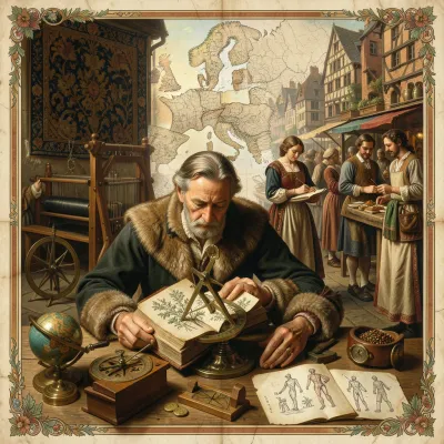
Maps, Charts, and Discovery: Cartography of the Renaissance
MTA
The transformation of geographical knowledge through mapmaking, voyages, and print
About this book:

"Maps, Charts, and Discovery: Cartography of the Renaissance" comprehensively examines the profound transformation of geographical knowledge and its representation during the 15th to 17th centuries. The book argues that Renaissance maps were not merely descriptive images but critical instruments that reshaped European understanding of the world, moving from a manuscript craft to a public, commercial, and scientific medium driven by exploration, print technology, and intellectual ambition. It delves into how the rediscovery of Ptolemy's "Geography" provided a foundational, yet frequently challenged, framework for cartographic development, prompting continuous revision as new discoveries emerged.
The book explores various cartographic genres and their specific purposes. Portolan charts, born from practical navigation, offered highly accurate depictions of coastlines for mariners, while cosmographies synthesized celestial and terrestrial knowledge. It details the crucial role of navigational instruments like the compass, astrolabe, and cross-staff in enabling oceanic voyages and improving latitude determination, contrasting this with the persistent challenge of longitude. A central theme is the transformative impact of the printing press, which democratized access to maps, fostering competitive innovation among workshops from Venice, Rome, and Nuremberg to the dominant northern hubs of Antwerp and Amsterdam.
Beyond technical and commercial aspects, the book investigates the political and cultural dimensions of mapping. It shows how maps were shaped by patronage from monarchs, cities, and the Church, and protected by "privileges" as early forms of copyright, often reflecting imperial ambitions and national rivalries, particularly between the Iberian empires and their cartographic secrecy. The text also covers the fascinating art of persuasion on maps, from decorative cartouches that conveyed status and narrative, to sea monsters that illustrated the boundaries of the known and the anxieties of the unknown. Finally, it highlights the educational function of maps in "theaters of the world" and cabinets of curiosities, concluding by tracing the enduring legacies of Renaissance cartography into the Enlightenment and modern digital mapping, demonstrating how these early innovations continue to shape our global understanding.
What You'll Find Inside:
- How the printing press transformed cartography from rare manuscript artifacts to mass-produced public knowledge, democratizing geographical understanding across European society.
- How Renaissance maps functioned as persuasive arguments rather than neutral representations, using decorative elements like sea monsters and cartouches to convey power, piety, and commercial interests.
- The critical role of navigational instruments (compass, astrolabe, cross-staff) in enabling long-distance voyages and how their limitations shaped early modern geographical knowledge.
- The evolution from Ptolemaic geographical frameworks to empirically derived maps through the tension between ancient authorities and new world discoveries, exemplified by the naming of America.
- The development of early atlases by Ortelius and Mercator as portable, curated worlds that standardized geographical knowledge while reflecting regional production centers and commercial networks.
Who's It For:
This book is ideal for historians of science and geography interested in the material and intellectual history of cartography, educators seeking primary sources for teaching about early modern exploration and knowledge production, and general readers fascinated by how maps shape our understanding of the world. It will particularly benefit those interested in the intersection of science, commerce, and art during the Renaissance period, as well as anyone wanting to understand how geographical knowledge was created, contested, and circulated in the age of discovery.
Table of Contents:
- Introduction
- Chapter 1 Mapping a New Age: From Manuscript to Print
- Chapter 2 The Legacy of Ptolemy: Text, Maps, and Renaissance Revisions
- Chapter 3 Portolan Charts and the Culture of the Sea
- Chapter 4 Instruments of Precision: Compass, Astrolabe, and Cross-Staff
- Chapter 5 Lines on the Globe: Latitude, Longitude, and Projection
- Chapter 6 The Printing Press and the Map Trade
- Chapter 7 Patronage, Privilege, and the Politics of Mapping
- Chapter 8 Discovery and Narrative: Columbus to Magellan
- Chapter 9 Naming the World: Toponyms, Languages, and Power
- Chapter 10 Cosmography, Geography, and Chorography
- Chapter 11 Centers of Production: Venice, Rome, and the Italian Workshops
- Chapter 12 Nuremberg to Antwerp: Northern Hubs and Networks
- Chapter 13 The Iberian Empires and Cartographic Secrecy
- Chapter 14 The Ottoman Mediterranean: Piri Reis and Beyond
- Chapter 15 America on the Map: From Waldseemüller to Mercator
- Chapter 16 Africa and the Indian Ocean Worlds
- Chapter 17 Asia, Jesuit Science, and Global Exchange
- Chapter 18 Imagining the Unknown: Terra Australis and Polar Spaces
- Chapter 19 City Views and Civic Pride: Civitates Orbis Terrarum
- Chapter 20 Sea Monsters, Cartouches, and the Art of Persuasion
- Chapter 21 Early Atlases: Ortelius’s Theatrum and Mercator’s Atlas
- Chapter 22 Errors, Corrections, and the Making of Authority
- Chapter 23 Mapping Nature: Winds, Currents, and Climates
- Chapter 24 Teaching with Maps: Classrooms, Cabinets, and Theaters
- Chapter 25 Legacies of the Renaissance Map: From Enlightenment to Today
Author:
Published By:
Date Published:
January 22, 2026
Type:
Nonfiction
Language:
English
Word Count:
72,134 words
Reading Time:
5 hours 3 minutes
Sample:
MixCache.com Total Access
Get unlimited access to this book + all books published by MixCache.com for $11.99/month
Subscribe to MTAOr purchase this book individually below
Order:
Buy the Maps, Charts, and Discovery: Cartography of the Renaissance ebook on MixCache.com:
Buy Now
Full ebook will be available immediately
- read online or download as a PDF file.
$5 account credit for all new MixCache.com accounts, usable toward any ebook purchase!*



Ratings & Reviews
Ask Questions About This Book
Have a question about the content? Ask our AI assistant!
Start by asking a question about "Maps, Charts, and Discovery: Cartography of the Renaissance"
Example: "Does this book mention William Shakespeare?"
Thinking...